

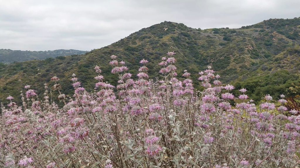
Eagle Rock Trail, located in the Topanga Canyon just off the scenic Highway 1, is one of the best trails to view wildflowers in the Santa Monica Mountains during spring. This hike features lush green hills, blossoming wildflowers and moderate temperatures ranging between 50-70 degrees on most days.
When it comes time to choosing the first hike for my Couch to Peaks Journey, Eagle Rock Trail was an easy pick. It’s rated as easy to moderate difficulty, offering a balance between mileage and elevation gain for someone new to hiking or just easing back into a hiking routine. It connects to several nearby trails, which means you can hike anywhere from 4 – 10+ miles depending on how much time & energy you have.
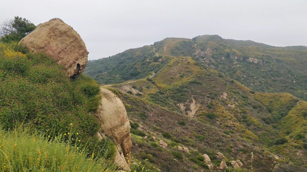
One of the best parts about Eagle Rock is its varied scenery. From wildflower-studded fields, open grasslands, to the giant sandstone outcrop / peak and the secret cave, this is a trail that rewards repeat visits. I always end up discovering something new every spring.


trail information
DISTANCE: 7 Miles
ELEVATION GAIN: 1312′
TRAILHEAD: Small parking lot off Entrada Road (see description for details)
RATING: Easy to Moderate
BEST TIME TO GO: Spring
DOWNLOAD GPX:
watch this hike on Youtube
I made a YouTube video of this hike — watch it here. 👇

trail description
Eagle Rock Trail is easily accessible from multiple trailheads within the Topanga Canyon and the greater Santa Monica Mountains. Since it’s part of the 66-mile Backbone Trail, there are several ways to visit Eagle Rock. You can make it a quick 2-hour hike or extend it into an all-day hiking adventure. I’ve listed some options below.
Trail Overview
- Trippet Ranch to Eagle Rock Loop (this is the classic loop)
- Trailhead: Trippet Ranch parking lot
- Distance: 4.6 miles
- Elevation Gain: ~950′
- Parking: $10 inside the parking lot
- Dead Horse Trailhead Variation (as shown in my video and described below)
- Trailhead: 34.092914, -118.597159
- Distance: 7 miles
- Elevation Gain: 1312′
- Parking: free in the small lot or street parking
- Santa Ynez Trailhead Variation (starting from Pacific Palisades)
- Trailhead: Santa Ynez Canyon Trailhead
- Distance: 9 miles
- Elevation Gain: ~1700′
- Parking: free street parking
Today’s hike started out on an use trail off the Entrada road. (This is the Dead Horse Trailhead Variation listed above)
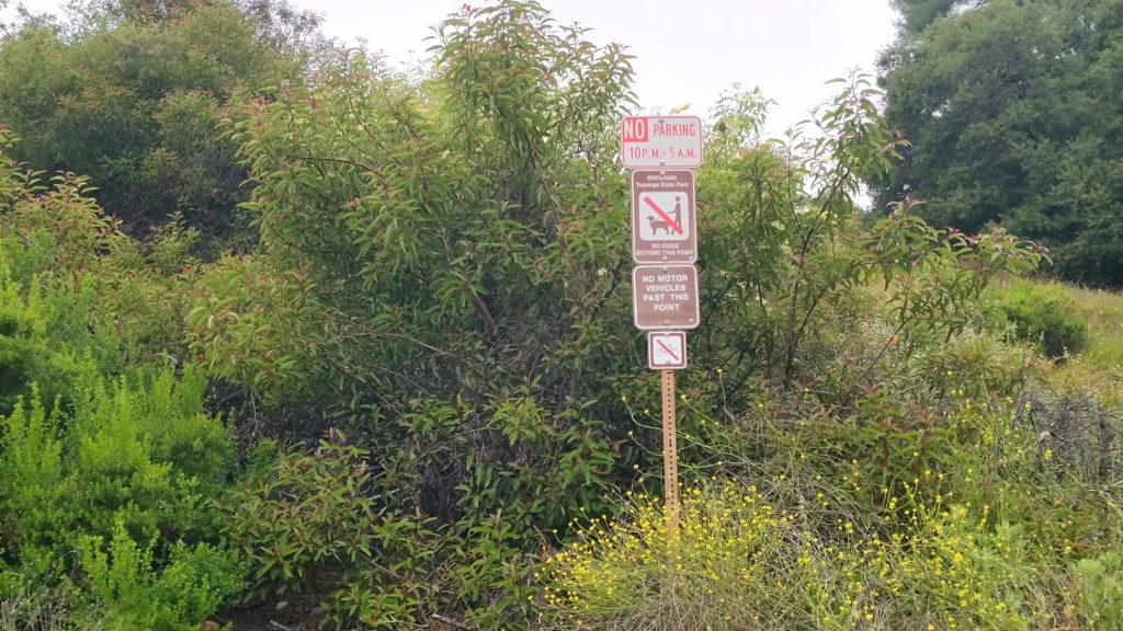
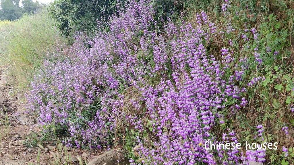
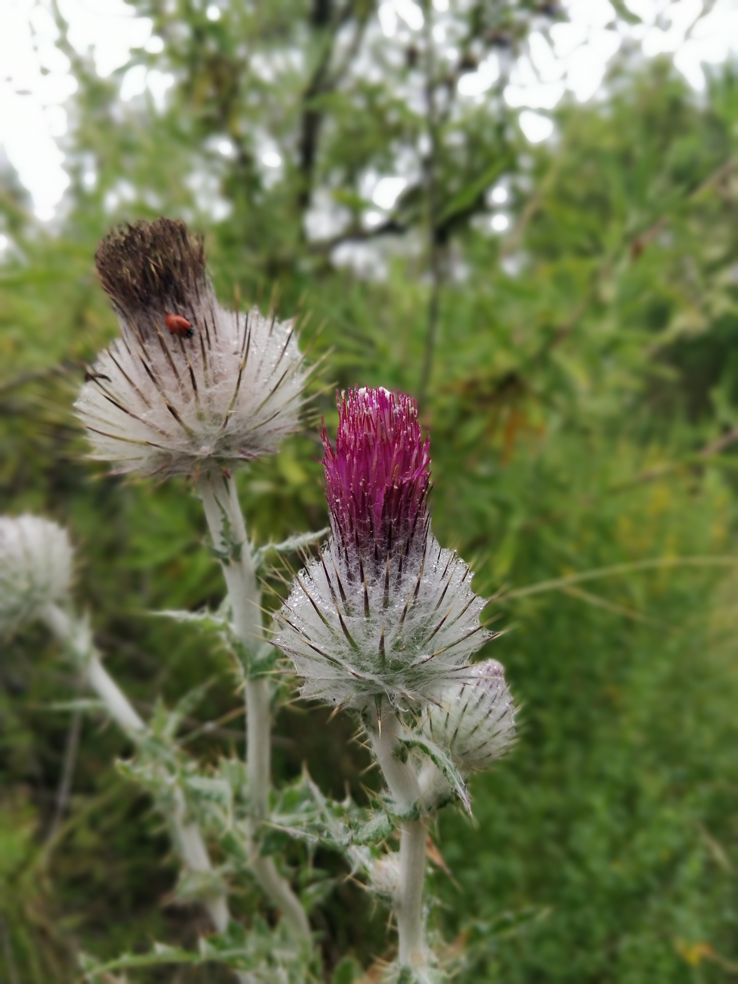
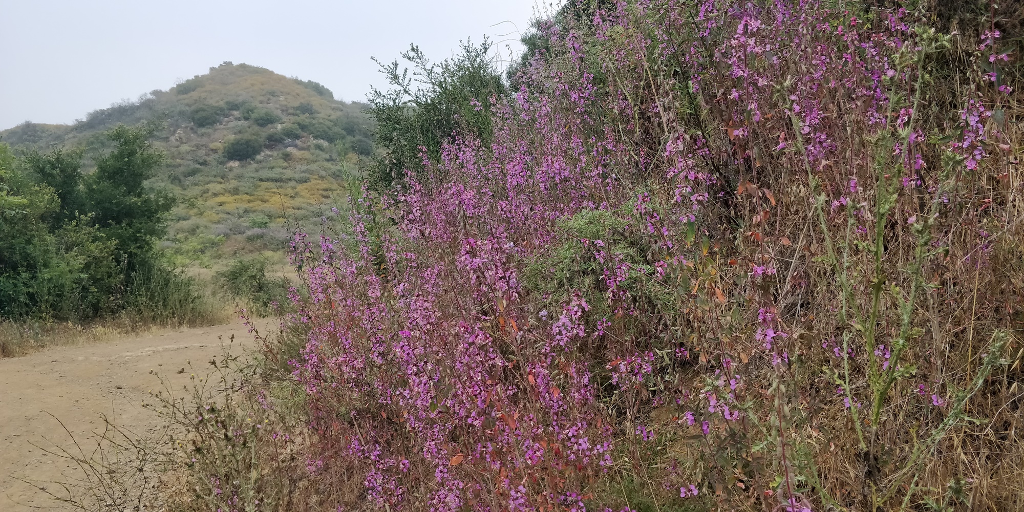
There’s a small parking area right in front of the trail. From there, I hiked gradually uphill, and immediately I was greeted with the most colorful display of wildflowers I’ve ever seen in this area in recent years.
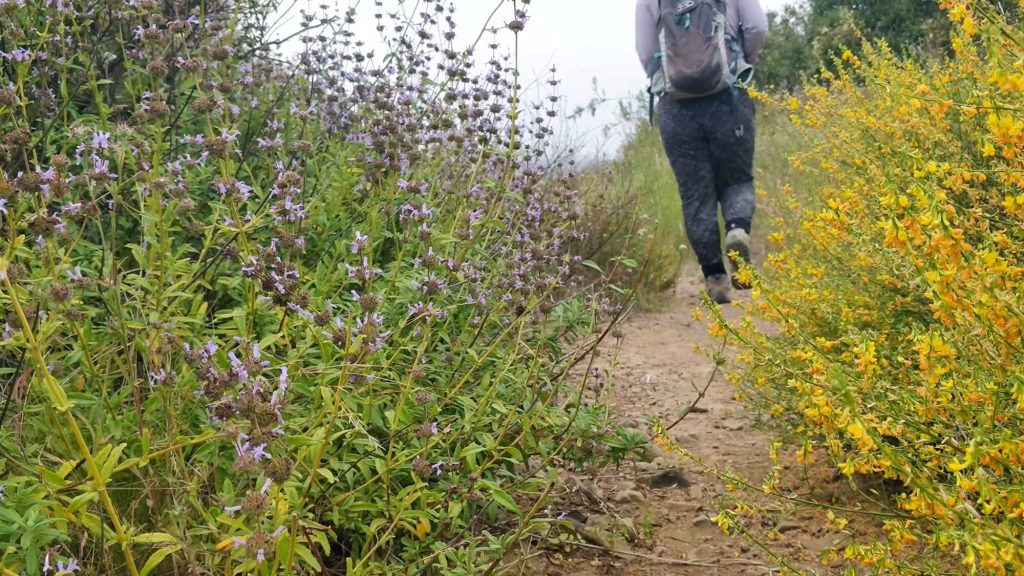
Through the dense marine layer, I could occasionally get a glimpse of Topanga Canyon in the distance. I took my time walking through the narrow trail lined with wildflowers.
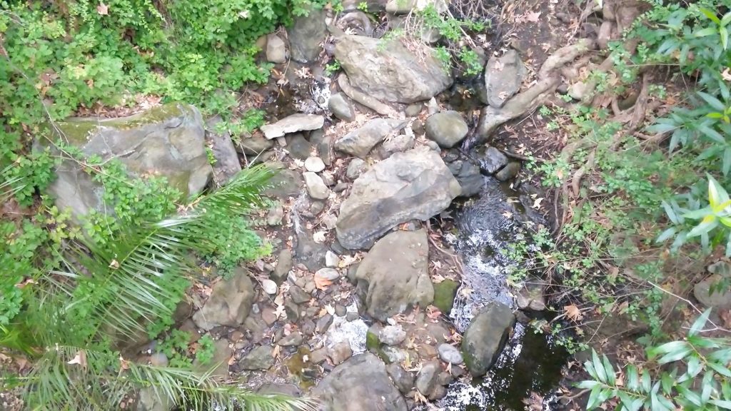
This trail connects to the Dead Horse Trail, and continues for just under 2 miles until it leads to Trippet Ranch parking lot. Along the way, I crossed a pretty little bridge. There’s even some water in the creek down below.
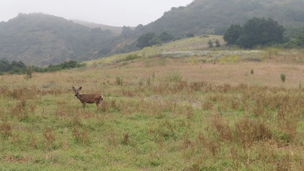
Pretty soon, the trail opens up to join some grassland. You can often spot deer here.
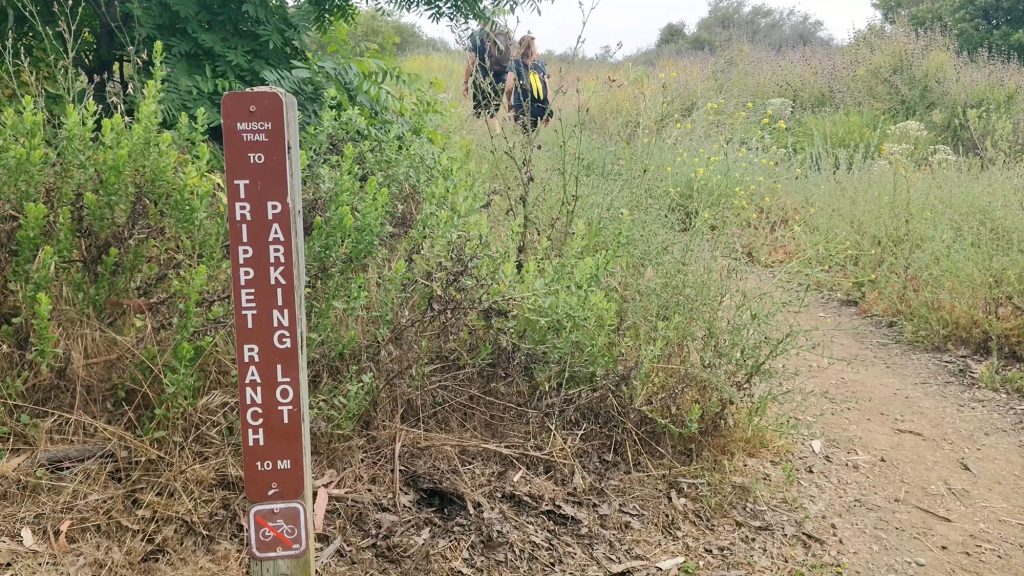
Trippet Ranch parking lot follows shortly after. This is the more common starting point for the Eagle Rock hike and you’ll see lot of cars and hikers here. I chose my trailhead because I wanted a longer hike today.
There are restrooms at this parking lot.
From the parking lot, I took the Eagle Springs Fire Road towards Eagle Rock.
The wildflowers are in full bloom here!
I soon reached a point where I decided to take a slight detour to visit a hidden gem.
And here it is.
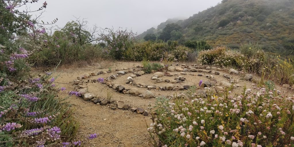
I first discovered this labyrinth two years ago, when I chose the path less traveled and noticed something new for the first time. I have hiked this trail numerous times before, but have never seen the labyrinth until I decided, for some reason that day, to turn left instead of right. It was a chance discovery that in hindsight, shouldn’t have taken that long for me to find. But sometimes we’re so set in our routines that we don’t take the extra steps to explore and discover all the beauty around us.
Two roads diverged in a wood, and I—
Robert Frost
I took the one less traveled by,
And that has made all the difference
I was reminded of this popular poem as I stared at the rock labyrinth, wondering how long it would’ve taken me to discover it, had I not been inspired to take a different path that day.
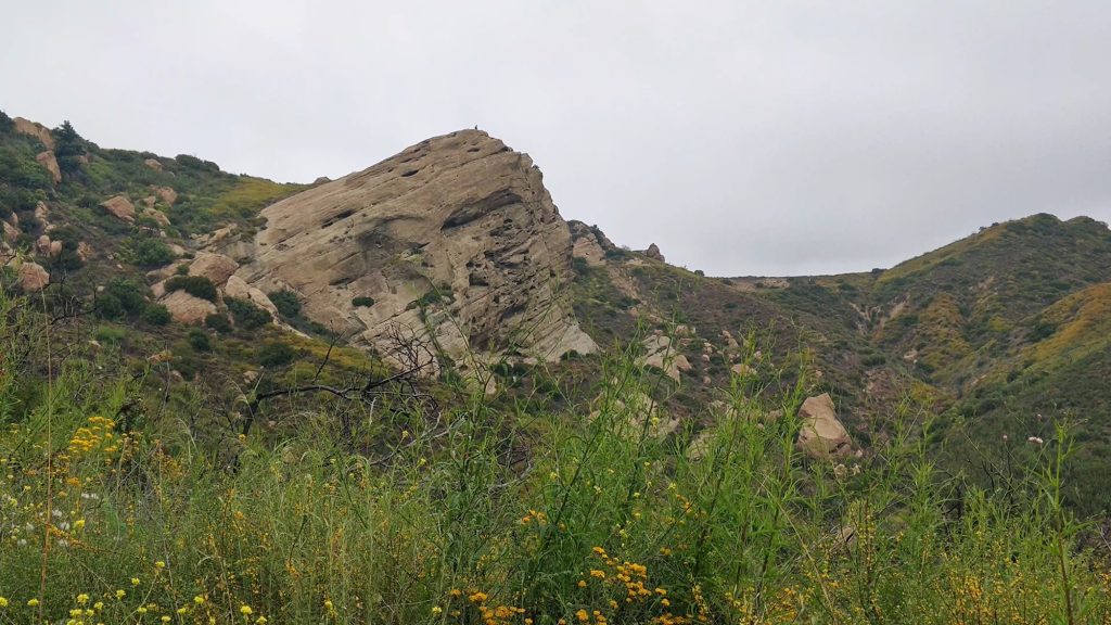
After taking a moment to meditate by the labyrinth, I continued towards Eagle Rock. From here it’s mostly a fire road all the way to the destination. In the spring, the hills are green and alive with wildflowers. On a clear day, you can see the ocean from here.

About a mile later I reached today’s destination, and my lunch break. Standing at 1957 feet, Eagle Rock gets its name from its unique shape. It’s a giant slab that gently slopes downwards like an eagle’s wing.
I scrambled up the craggy surface and entered a secret cave. This looks like a good spot for a break!
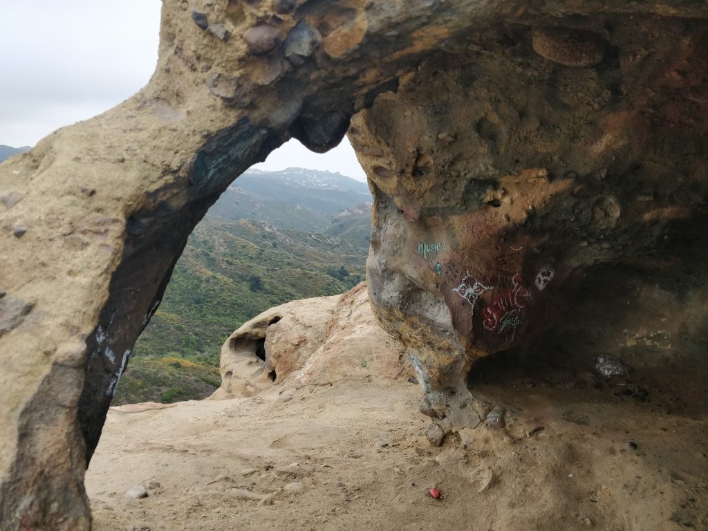
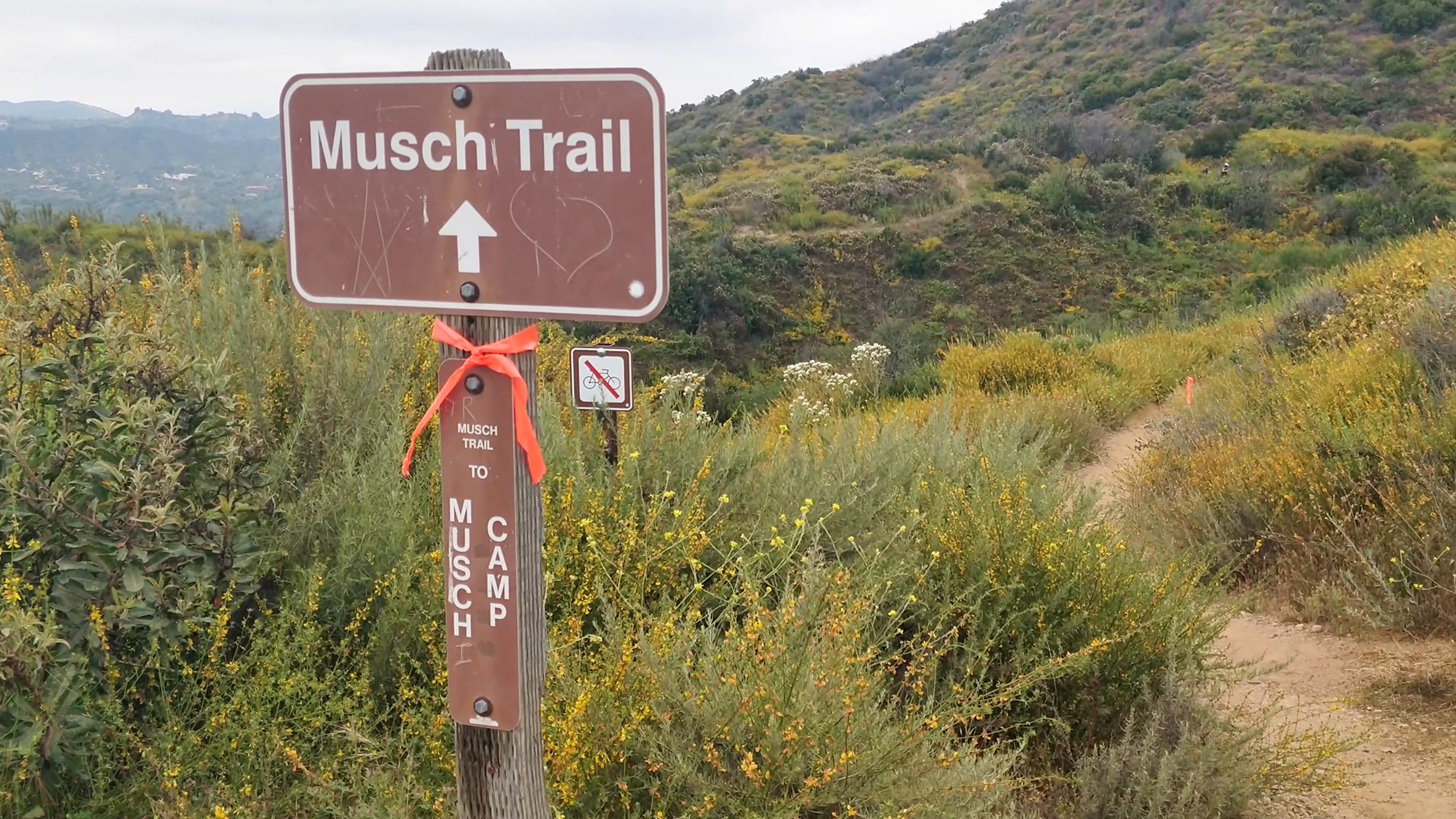
After taking in this beautiful view from inside the cave one last time, I backtracked my route a little, until I reached the Musch trail junction.

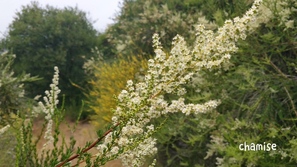
The Musch trail will take me back to Trippet Ranch through mostly a single track trail instead of the fire road. It’s slightly longer but much prettier in my opinion. It cuts through chaparral and sagebrush terrain and during the spring, you will be rewarded with wildflowers scattered throughout the trail.
I always find the return trip longer for some reason. This is where my mind usually tends to wander. I forced myself to focus on the trail instead, listening to the sounds of nature surrounding me, the buzzing bees, chirping birds… the occasional snapping of branches that made me look around for wildlife.
Finally, I got back to my car. I forgot to turn my GPS tracker off so my recorded distance was incorrect. After checking Caltopo website, my hike came in at a total of 7 miles and 1312 feet climbed.
Trail Highlights
- Peak Wildflowers: April – Mid May (varies slightly by year)
- Difficulty: Easy to Moderate
- Family Friendly: Yes, with caution for elevation gain and uneven terrain
If you’re looking for a spectacular wildflowers hike in SoCal during spring season, Eagle Rock Trail is a great choice.
Do you have a favorite wildflowers hike? Share your trail in the comments below.
Happy hiking, and enjoy the wildflowers! 🌺🌼🪻
P.S. This is Hike #1 of my Couch to Peaks series. I’m in the process of transforming myself from a couch potato to a peak bagger. Check out my journey here.
download GPX
Download Eagle Rock Trail GPX


Leave a Reply