

The Kumano Kodo (熊野古道) is a network of ancient pilgrimage trails that span over 300 kilometers across the Kii Peninsula in Japan’s Wakayama prefecture. Among its many routes, the Nakahechi Route is the most accessible and widely walked option for first-time pilgrims.
This guide is for people who want to plan the Nakahechi thoughtfully, without rushing the experience. It covers route options, logistics, difficulty, luggage transport, accommodation styles, weather, and common planning mistakes — all based on my firsthand experience walking the trail.
Whether you are considering hiking the full Nakahechi route, or walking even part of the trail highlights, this article will help you plan your trip with confidence.
Kumano Kodo Pilgrimage Series
If you’re thinking about walking the Kumano Kodo pilgrimage, I’ve written a series of posts on planning your Kumano Kodo hiking adventure.
This post is Part 2 of my Kumano Kodo Series. If you missed part 1, I shared my own experience hiking segments of the Nakehechi Route in 4 days. The rest of the series are linked below.
Kumano Kodo Pilgrimage Series


- Watch this Guide on Youtube
- What is the Kumano Kodo Nakahechi Route?
- Where Does the Nakahechi Route Start and End?
- How to Qualify for the Dual Pilgrimage Status?
- How Difficult is the Nakahechi Route?
- How Many Days Do You Need for the Nakahechi?
- Sample Itineraries
- Accommodations Along the Nakahechi Route
- Luggage Forwarding: How It Works
- Weather and Best Time to Visit Kumano Kodo
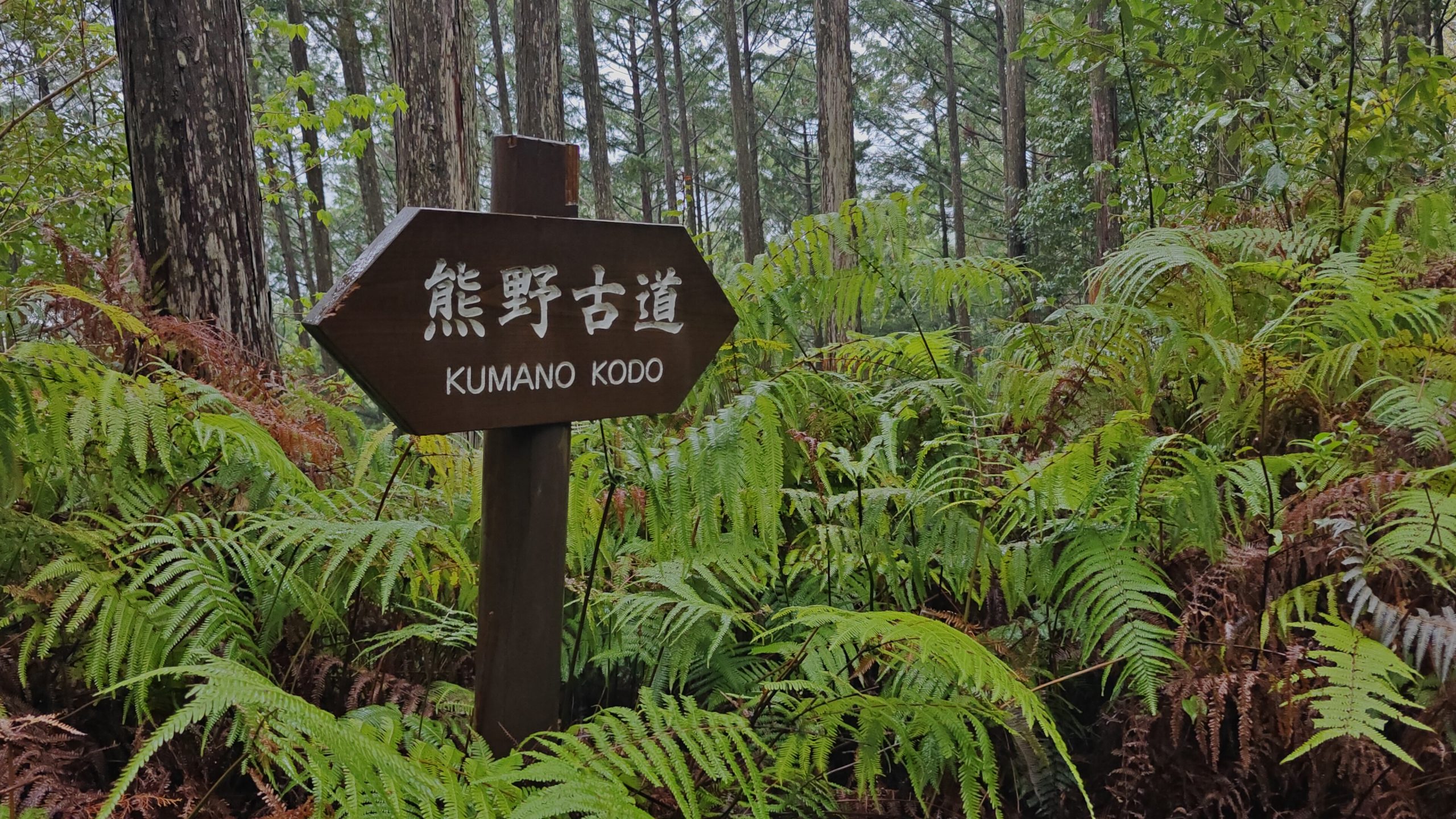
- Navigation & Trail Marking
- Cultural Etiquette on the Trail
- Common Planning Mistakes
- Trail Safety & Precautions
- Why Walk the Nakahechi At All?
- Before & After the Pilgrimage
- Final Thoughts
- Frequently Asked Questions
- More on My Kumano Kodo Series
Watch this Guide on Youtube
I made a YouTube video going over the most important parts of the Nakahechi guide. You can watch it here. 👇
What is the Kumano Kodo Nakahechi Route?
The Nakahechi is the primary inland pilgrimage route connecting Takijiri-oji to the three grand shrines known as the Kumano Sanzan:
- Kumano Hongu Taisha
- Kumano Nachi Taisha
- Kumano Hayatama Taisha
This route was walked by emperors, aristocrats, monks, and commoners seeking purification, healing, or spiritual clarity. It’s also known as the Imperial Route.
Today, it remains the most popular route because it balances accessibility with immersion in nature and history.
Other routes of the Kumano Kodo include:
- Kohechi: the Mountain Route. It’s a steep, remote, and much more demanding trail compared to Nakahechi, with several high mountain passes.
- Ohechi & Iseji: the Coastal Routes. They follow the coastline of Wakayama and offer incredible ocean views. They feature gentler elevation compared to the inland routes.
Where Does the Nakahechi Route Start and End?
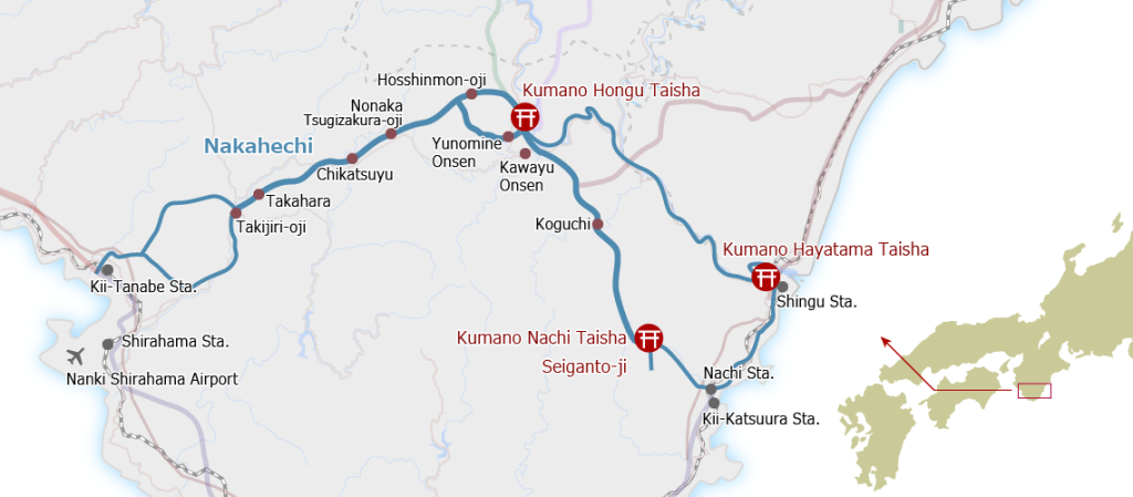
Traditional start: Takijiri-oji
Common endpoint: Kumano Nachi Taisha (via Hongu)
Distance: 68 km | 43 miles for the full Nakahechi
The full Nakahechi starts in Takijiri-oji and ends at Kumano Nachi Taisha. Historically, pilgrims walked from Takijiri-oji to Kumano Hongu Taisha, then took the boat to Kumano Nachi Taisha.
Most pilgrims today do not walk the entire historical route. Instead, people choose sections based on time, fitness, and interest.
Typical Nakahechi itineraries include:
- Takijiri-oji → Kumano Hongu Taisha (38 km | 24 miles)
- Hongu → Nachi (via Koguchi) (30 km | 18-19 miles)
- Full Nakahechi from Takijiri-oji → Nachi (68 km | 43 miles)
- Walking short sections such as:
- Takijiri-oji → Takahara
- Hosshinmon-oji → Kumano Hongu Taisha
- Daimonzaka → Nachi
You can walk the pilgrimage in as little as 2 days or stretch it to 5–7 days for a slower, more reflective pace. From my experience & research, 4-6 days on the trail seem to be the most common itinerary.
How to Qualify for the Dual Pilgrimage Status?
The Kumano Kodo is one of only two pilgrimage routes designated as a UNESCO World Heritage Site. The other one is the Camino de Santiago in Spain. If you complete both trails, you’ll get a special dual pilgrimage certificate.
There are several ways to qualify for the Kumano Kodo portion of the Dual Pilgrimage. If you’re interested, the official website has all the details on which trail sections you need to complete and what stamps you need to collect along the way.
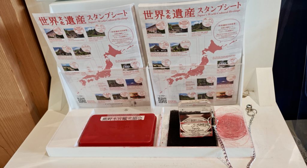
Collecting Kumano Kodo Stamps
Along the Kumano Kodo, you’ll pass several stamp stations, each marking a waypoint on the pilgrimage. Usually these stamp stations are located right next to the shrines. At the bigger shrines such as the three grand shrines, they’re located near the place where they sell Omamori (amulets for specific fortunes like health, love, success).
Even if you’re not interested in qualifying for the Dual Pilgrimage, collecting these stamps in the official stamp passport (or your own booklet) makes for a fun souvenir to bring home afterwards. You can pick up the official stamp passport at Tanabe, Takijiri, and Kumano Hongu Taisha visitor centers.
How Difficult is the Nakahechi Route?
The Nakahechi is moderate, but it should not be underestimated.
What makes it manageable:
- well maintained trails
- frequent village stops, with resupplies for water & food available
- luggage forwarding services
- clear navigation
- encountering fellow hikers frequently
What surprises many hikers:
- steep & uneven stone staircases
- constant rolling elevation rather than long flat stretches
- humidity during warmer months
What You’ll Need:
- comfortable hiking shoes
- basic endurance
- some prior experience hiking 8-14 km days with some steep ascent and descent
- trekking pole for balance and steep sections
If you’re interested in a detailed packing breakdown, I cover that separately in How to Pack for Your Kumano Kodo Pilgrimage.
How Many Days Do You Need for the Nakahechi?
This depends on which sections you choose, not just distance.
Common breakdown
- 2–3 days: Short sections only
- 4 days: A balanced itinerary with time for shrines and rest
- 5–6 days: A slower, immersive pilgrimage with more time for reflection and rest
If you want to know what it looks and feels like hiking the most scenic sections of the Nakahechi route, I covered it in 4 Days on the Kumano Kodo Trail – Waterfalls, Shrines & Unexpected Encounters on the Nakahechi Route.
Sample Itineraries
If You Have 2-3 Days
- Day 1: Walk from Hosshinmon-oji to Kumano Hongu Taisha. Visit the original Hongu Taisha site at Oyunohara. Relax at a hot springs onsen afterwards (such as Yunomine Onsen or Watarase Onsen).
- Day 2: Take the bus to Daimonzaka trailhead. Hike to Nachi Falls & Kumano Nachi Taisha. Nachi Falls is Japan’s tallest single drop waterfall is well worth a visit. From there you can walk to Kumano Nachi Taisha, passing the tall red pagoda with the waterfalls in the background. After visiting Kumano Hongu Taisha, get on the short bus ride to visit the third and final grand shrine — the Kumano Hayatama Taisha — to complete your pilgrimage.
- Day 3 Options:
- You can use this day as a travel day to Tanabe before your hike.
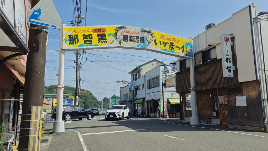
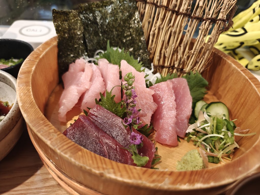
- Alternatively, you can save the third day to explore Nachikatsuura, a tranquil seaside town known for their fresh tuna and a giant onsen built inside a cave.
Who it’s for: Suitable for casual walkers, first-time visitors, or those short on time
If You Have 4 Days
- Day 1: Walk from Takijiri-oji → Chikatsuyu.
- Distance 18–20 km | 11–12.5 miles
- Elevation Gain: 1100-1300 m | 3600-4300 ft
- Elevation Loss: 900-1100 m | 3000-3600 ft
- Day 2: Walk from Chikatsuyu → Kumano Hongu Taisha.
- Distance: 18–20 km | 11–12.5 miles
- Elevation Gain: 700–900 m | 2300–3000 ft
- Elevation Loss: ~900–1100 m | 3000–3600 ft
- Day 3: Walk from Kumano Hongu Taisha → Koguchi.
- Distance: 13 km | 8 mi
- Elevation Gain: 800 m | 2600 ft
- Elevation Loss: 700 m | 2300 ft
- Day 4: Walk from Koguchi → Kumano Nachi Taisha.
- Distance 14 km | 8.7 mi
- Elevation Gain: 1200 m | 3900 ft
- Elevation Loss: 1000 m | 3300 ft
If you’re not used to walking such long distances, you can walk from Takijiri-oji to Kumano Hongu Taisha in three days and take the bus to visit Kumano Nachi Taisha and Kumnano Hayatama Taisha on the last day.
Who it’s for:
- Takijiri-oji -> Kumano Nachi Taisha in 4 days: suitable for experienced long-distance hikers comfortable with sustained elevation gain and long days
- Takijiri-oji -> Kumano Hongu Taisha in 3 days, then Bus to Kumano Nachi Taisha: suitable for regular hikers or those with a solid fitness base who are comfortable with long days and steady elevation gain.

If You Have 5-6 Days
This is the most relaxed and immersive way to hike the Nakahechi route. This gives you time to complete the trail at a more leisurely pace and still have enough time to appreciate the rich cultural and spiritual heritage of the journey. If I have a chance to revisit Kumano Kodo, I’d pick this itinerary.
- Day 1: Travel to Kii-Tanabe. Walk from Takijiri-oji to Takahara.
- Distance: 4 km | 2.5 mi
- Elevation Gain: 300–400 m | 1000–1300 ft
- Day 2: Continue from Takahara → Tsugizakura-oji.
- Distance: 13 km | 8 mi
- Elevation Gain & Loss: 400-500m | 1300-1600 ft
- Day 3: Walk from Tsugizakura-oji → Kumano Hongu Taisha.
- Distance 21 km | 13 mi
- Elevation Gain: 900 m | 2950 ft
- Elevation Loss 1250 m | 4100 ft
- Day 4: Take a rest day.
- Enjoy the onsens at Yunomine Onsen, Watarase Onsen or Kawayu Onsen.
- Day 5: Continue from Kumano Hongu Taisha → Koguchi.
- Distance: 13 km | 8 mi
- Elevation Gain: 800 m | 2600 ft
- Elevation Loss: 700 m | 2300 ft
- Day 6: Follow the Nakahechi route from Koguchi → Kumano Nachi Taisha.
- Distance 14 km | 8.7 mi
- Elevation Gain: 1200 m | 3900 ft
- Elevation Loss: 1000 m | 3300 ft
Who it’s for: suitable for hikers with strong endurance who are comfortable with sustained climbs and descents, including steeper terrain in the final days when fatigue has accumulated.
Summary of Sample Itineraries
| Number of Days | Route | Distance (approx) | Style | Difficulty Level |
|---|---|---|---|---|
| 2-3 Days | Hosshinmon-oji → Kumano Hongu Taisha, and Daimonzaka → Nachi Falls + Kumano Nachi Taisha | 7.5 km (5 miles), 4.5 km (2.8 miles) | scenic section walks | 🥾 |
| 4 Days | Takijiri-oji → Kumano Nachi Taisha | 68 km | 43 miles | fast paced thru-hike | 🥾🥾🥾🥾🥾 |
| 4 Days | Takijiri-oji → Kumano Hongu Taisha | 38 km | 24 miles | moderate paced route | 🥾🥾🥾 |
| 5-6 Days | Takijiri-oji → Kumano Nachi Taisha | 68 km | 43 miles | thru-hike at a relaxed pace | 🥾🥾🥾🥾 |
🥾🥾🥾🥾🥾 = most strenuous
🥾 = easiest
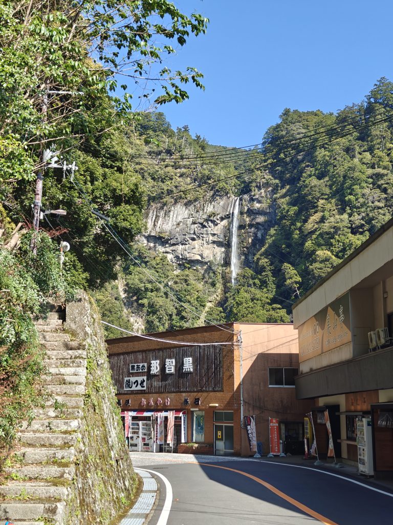
Accommodations Along the Nakahechi Route
Accommodation shapes much of the Nakahechi experience.
Most walkers stay in:
- Minshuku (family-run guesthouses)
- Ryokan (traditional inns)
- Hostels
- Hotels in larger towns
Stays along the route typically include:
- dinner and breakfast
- shared bathing facilities
- early curfews and quiet evenings
I go into more detail about what these stays are like in Lodging Types on the Kumano Kodo & My Personal Experiences, including a few things that surprised me and what I would approach differently next time.
One practical note: accommodations along the Nakahechi are limited, especially in smaller villages. During peak seasons in spring and autumn, rooms tend to fill quickly. Booking around six months in advance generally offers the best balance between availability and flexibility.
You may see recommendations to book even earlier, but that timeline may not be practical for every traveler.
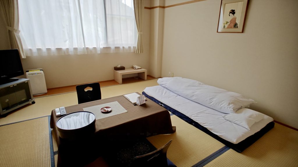
Luggage Forwarding: How It Works
One reason the Nakahechi is accessible to a wide range of walkers is Japan’s luggage forwarding system.
Along the route, you can:
- send your main luggage ahead to your next accommodation
- walk each day with only a daypack
- arrange forwarding through your lodging or local luggage services
Using luggage forwarding lightens the physical load and keeps daily walking focused on the trail rather than managing gear.
Opting Out of Daily Luggage Forwarding
Some walkers choose a simpler approach.
Instead of forwarding luggage from stop to stop, you can:
- send your main bag ahead to your final hotel or onward destination
- carry everything you need for the walk in a single daypack
This removes the need to coordinate daily luggage transfers and keeps logistics minimal during the hike.
This is the option I chose. If you’re curious about what I carried for four days on the Nakahechi, I break down my packing list in How to Pack for Your Kumano Kodo Pilgrimage.
Weather and Best Time to Visit Kumano Kodo
The Nakahechi can be walked year-round, but conditions vary significantly.
Spring (March–May)
- mild temperatures
- cherry blossoms at lower elevations
- occasional rain
Summer (June–September)
- hot and humid
- lush greenery
- frequent rain and typhoons
Autumn (October–November)
- cooler temperatures
- fall foliage
- popular season, requires advance booking
Winter (December–February)
- quiet and atmospheric
- cold mornings
- occasional trail closures
Trail conditions change frequently. Always check official Kumano Kodo sources or local tourism offices before starting your hike.

Navigation & Trail Marking
The Nakahechi is well marked, but navigation still requires attention.
You’ll encounter:
- wooden signposts
- stone markers
- directional arrows at junctions
Most hikers also carry:
- offline maps
- GPX tracks
- printed route notes
Losing the trail is uncommon but possible near villages or road crossings.
One of the quieter reassurances of walking the Nakahechi is that help often appears when you need it — whether from fellow hikers or locals who know the trail well. Some of my most memorable moments on the pilgrimage came not from the path itself, but from these brief, unexpected encounters along the way. I share one of those trail angel stories, along with other standout moments, in Top Memories from My Kumano Kodo Pilgrimage.
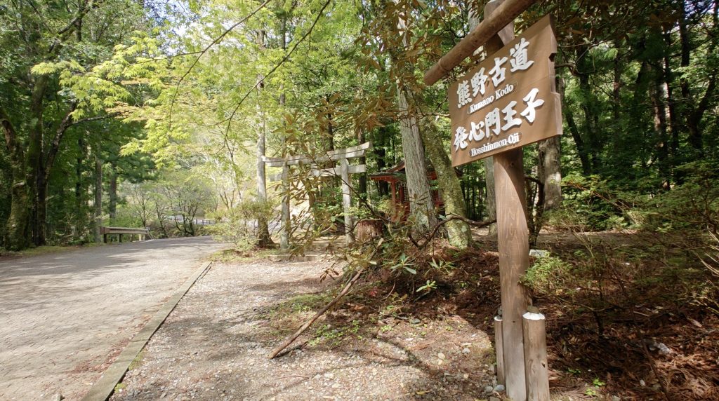
Cultural Etiquette on the Trail
Basic etiquette includes:
- respecting shrine spaces
- keeping noise levels low
- removing shoes where required
- greeting locals and other hikers
Small gestures go a long way, especially in rural communities that see fewer international visitors.

Common Planning Mistakes
Booking accommodations too late
Accommodations are limited. Book early to get the best selection.
Underestimating humidity
Even moderate distances can feel demanding in warm, wet conditions.
Overpacking
Use luggage forwarding or carry only the essentials
Rushing the walk
The Nakahechi rewards patience more than speed.
Skipping shrine time
The spiritual element of the route matters as much as the physical walk.
Trail Safety & Precautions
The Nakahechi is a well-established and popular route, but a few practical considerations are worth keeping in mind as you plan your walk.
Uneven stone steps and exposed roots
Some sections are more irregular than they appear, especially on descents. Slower footing and added stability, such as trekking poles, can be helpful.
Limited cellphone reception
Signal can be unreliable in forested and mountainous areas. If you plan to use your phone for navigation, download maps in advance.
Changeable weather
Conditions can shift quickly, particularly during wetter seasons. Rain increases the risk of slippery stone steps and muddy sections.
Infrequent bus schedules
Local buses connect villages and trailheads, but service can be limited. It’s worth checking schedules ahead of time so you’re not caught waiting at the end of the day.
Bear safety
Bear sightings are extremely rare on the Nakahechi. Carry a bear bell if you’re concerned.
Why Walk the Nakahechi At All?
People walk the Kumano Kodo for many reasons:
- personal transformation
- curiosity about Japanese spirituality & culture
- interest in exploring the quieter side of Japan
- desire for solitude
What surprised me the most was how my time on the Nakahechi settled into a quiet meditation after several days of walking. The trail subtly invited change and transformation, even though I didn’t actively seek them.
I explore this more personally in Top Memories from My Pilgrimage.
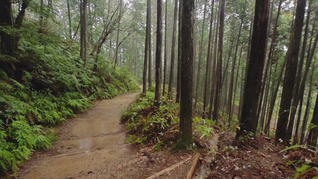
Before & After the Pilgrimage
Many hikers combine the Nakahechi with:
- A Day Zero in Kii Tanabe to get ready for the pilgrimage
- A rest day in Hongu to explore nearby hot springs onsens
- A recovery day in Nachikatsuura
- Visiting Osaka and Kyoto before continuing your Japan trip
Ideas for extending your trip are covered in What to Do Before & After Kumano Kodo: Trip Extension Ideas.

Final Thoughts
The Nakahechi route invites a slower kind of walking—one shaped by forest paths, ancient shrines, and long stretches of quiet that allow the landscape to unfold gradually. What stayed with me most was not the mileage, but the feeling of moving through a place shaped by centuries of pilgrimage, where time seems to slow and attention naturally sharpens.
If you approach the pilgrimage with respect, curiosity, and patience, the trail will meet you where you are.
About this Guide
I walked the Kumano Kodo Nakahechi route independently, staying in local minshuku and ryokan and using public transportation services along the way. The guides and reflections linked here are written from my direct experience on the trail and are intended to help others plan with realistic expectations.
Trail conditions, weather, and accommodation availability change frequently. Always confirm current details with official Kumano Kodo resources before starting your walk.
Frequently Asked Questions
More on My Kumano Kodo Series
Whether you’re drawn by the history, the spirituality, or the sheer beauty of rural Japan, the Kumano Kodo Nakahechi Route offers a rare chance to slow down, reconnect, and walk with intention.
If you’re planning your own Kumano Kodo journey, make sure to check out all the posts in this series:
If it’s helpful to see the terrain, here’s my Kumano Kodo Playlist on YouTube.

Leave a Reply